Startups
Google Maps is no longer #flatearth


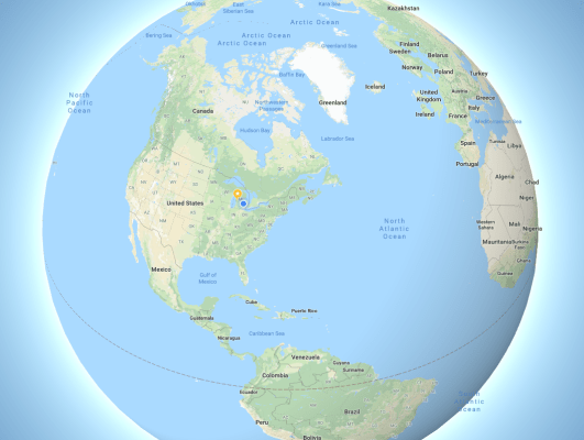
Go to Google Maps and zoom out. Halfway out, the map’s perspective changes from a traditional flat map view to an interactive globe. Zoom all the way out and the Earth is presented as a globe with landmasses of the appropriate size. Greenland is no longer the size of Africa and all is right with the world.
On flat maps, it’s impossible to represent land mass size on a relative scale. Objects in the north and south become distorted as the the flat map compensates for the flattening of the globe. This is most evident in the commonly used Mercator projections that properly represents the size of land around the equator but super-sizes land in the Arctic and Antarctic.
Now, when Google Maps is used on Desktop, users will see the appropriate size of land masses. The update is great but I have yet to find the giant ice wall that’s preventing all of life from sliding off the side of the flat earth and onto the back of the giant turtle we’re riding through the vast emptiness of space.
-

 Entertainment7 days ago
What’s new to streaming this week? (Jan. 17, 2025)
-

 Entertainment6 days ago
Explainer: Age-verification bills for porn and social media
-

 Entertainment6 days ago
If TikTok is banned in the U.S., this is what it will look like for everyone else
-

 Entertainment6 days ago
‘Night Call’ review: A bad day on the job makes for a superb action movie
-

 Entertainment6 days ago
How ‘Grand Theft Hamlet’ evolved from lockdown escape to Shakespearean success
-

 Entertainment6 days ago
‘September 5’ review: a blinkered, noncommittal thriller about an Olympic hostage crisis
-

 Entertainment6 days ago
‘Back in Action’ review: Cameron Diaz and Jamie Foxx team up for Gen X action-comedy
-

 Entertainment6 days ago
‘One of Them Days’ review: Keke Palmer and SZA are friendship goals


